Exploration: Loon Pond Mountain
By Mrs. Lucia D. Pychowska (Appalachia: The Journal of the Appalachian Mountain Club, vol. 2 (1879–1881))
Narrated by John Saunders.
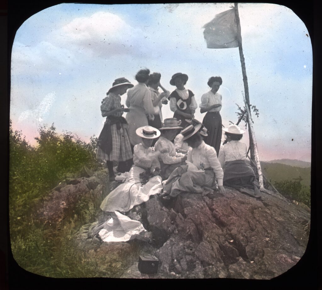
“Top of Loon Mountain,” undated glass lantern slide, UPHS, Hallworth Collection.
Loon Pond Mountain lies between Scar Ridge and the valley of the East Branch of the Pemigewasset. It has been burnt over several times, and its upper portion is covered with the low growth of deciduous trees usually following such catastrophes among the mountains of New Hampshire. Its southern side is scarred with bare, rocky ledges, and these two causes give to it a hue so much lighter than that of the surrounding eminences, that it is a noticeable object from many points, far and near. This fact, showing that an extended view must be attainable from its summit, joined to the reputation for loveliness of situation pertaining to the two lakes, induced our party to visit the place.
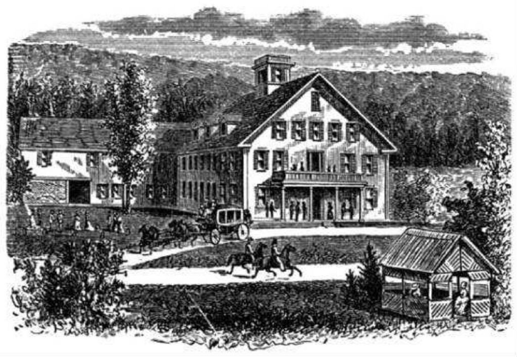
Etching of the Blair Hotel, c. 1890 (from Rowan 1995).
September 21, 1880, Mr. E. B. Cook and five ladies left Blair’s, in Campton, for Pollards’, near the mouth of the East Branch, — the ladies in mountain-wagon, Mr. Cook on foot. Here we passed the night. The weather on the morning of the 22nd was lowering, but a cold northwest wind promised to lift the clouds somewhat. When we asked for a guide, Mr. Dura P. Pollard said he would gladly go with us, but we might find some difficulty in getting over the East Branch, as the river was considerably swollen by the recent rains. In case we could not cross, we should have to go to Sharon, three miles down the valley, and ascend from there. This had not made part of our plan, so we determined to try the crossing at the Pollard place. The lakes were said to be three miles from the house, and the top of the mountain a mile farther on, the trail to the lakes indistinct, and no trail at all to the summit.
Crossing the intervale, the river was soon reached, and we ladies looked in dismay at the broad, rushing stream. The sunlit, forest-clad banks, and the clear, sparkling water dancing about the great granite boulders, would have made a charming sketch, if time had not failed our artist.
Mr. Pollard fell two small birches, and laid the trunks across from rock to rock over the current where swiftest and deepest. A supply of stout walking-sticks was also speedily cut, and, thus equipped, we started on the watery passage. At the end of the frail bridge there was nothing to be done except to continue on through the stream, choosing, in addition to the few dry stones, such as were not more than six inches under water. Although totally unprepared for such an experience, our ladies marched cheerily through, and soon reached dry land again, with nothing worse than wet feet, which speedily dried on the upward stretch through the beautiful forest of maple, beech, birch, and hemlock, which covers the northern slope of the mountain. The undergrowth is of the ubiquitous hobble-bush (Viburnum lantanoides), and the American yew (Taxus Canadensis).
There were blazes on the trees, and the trail was indistinctly visible among the fallen leaves, until the top level was reached, when it nearly disappeared among the ledges and the low bushes which here replaced the noble forest trees.
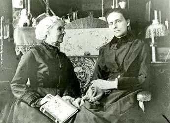
Lucia Cook Pychowska and her daughter, Marian Pychowska, c. 1885 (from Rowan 1995).
A slight detour took us to a famous ledge of milky quartz, several feet in height, and of considerable length. This passed, we soon came out upon the larger lake, a beautiful sheet of water, covering about fifty acres of surface, quite deep, very clear, still holding trout, and bordered by wooded or rocky shores. Sheep-laurel (Kalmia angustifolia), leather-leaf (Cassandra calyculata), Labrador tea (Ledum latifolium), pitcher-plant (Sarracenia purpurea), and dwarf cornel (Cornus Canadensis) grow in abundance round the basin. Under the high rocks at the easterly end, we found the pretty fern, Cystopteris fragilis.
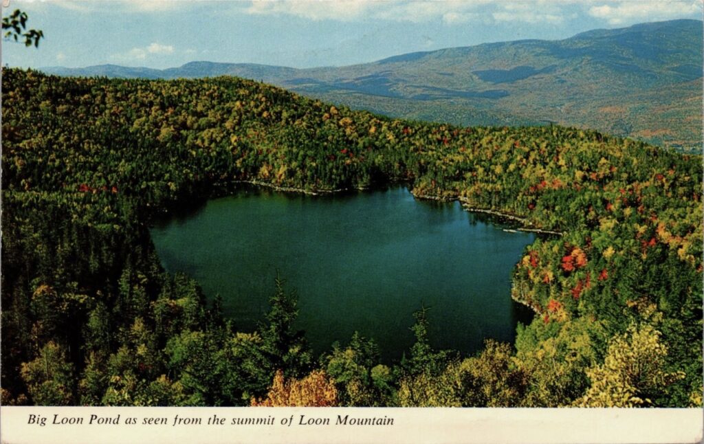

Vintage Real Photo Postcard (RPPC), post-dated September, 1971: Big Loon Pond as seen from the summit of Loon Mountain. Color Photo by Dick Smith.
To the southeast of the lake rise three rocky heads inviting to a farther climb. From the first and lowest summit we had a charming view of the lakes, — the smaller one, a rock-set gem, apparently a little lower down than the larger. Over them, on the other side of the valley of the East Branch, towered Mts. Cannon, Lafayette, Liberty, and Flume, all clear and dark against a cloudy sky.
The two succeeding heads were divided from each other by shallow ravines, and the way lay through low trees, bushes, broken rocks, fallen timber, with every now and then a diversion in the shape of a slope of sliding, decayed rock, similar to that of the slide on Tripyramid. The extreme southern head reached, proved to be made of this friable material, and afforded coasting privileges to such as cared to enjoy them. The larger ledges are of a firmer granitic rock, much worn and rounded by the action of former glaciers and more recent wintry weather. Great boulders are scattered about in unexpected places, and the higher rocks are split into picturesque blocks and shafts.
The mouth of the East Branch is given as 712 feet above the sea level. Mr. Pollard’s house is a few feet higher, say 750 feet above tide water. Loon Pond is presumed to be about 2,000 feet above the valley, and the highest summit 200 feet above the pond; making an aggregate of 2,950 feet for the entire height of Loon Pond Mountain. This may be so, but judging merely from the impression produced by the one ascent, the writer would be inclined to take off a couple of hundred feet from the height of the lake above the valley, and add one or two hundred feet to the height of the summit above the lake.
After a short enjoyment of the charming view, a plunge through the scrubby maze of the burnt district took us over the mile down to the lake, and thence, by an easier passage, we made the river-bank once more. There our attentive guide led us over the broad stream to the house, where dry shoes and an excellent dinner awaited us.
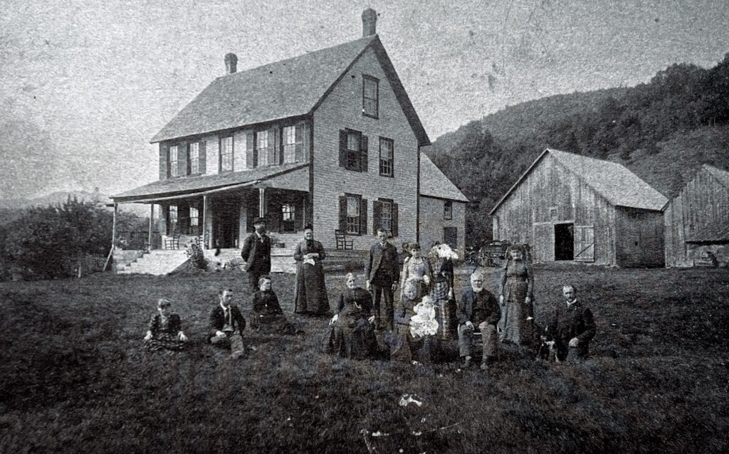
The Pollard Farmhouse. Built c. 1845, it was well known as a haven for hunters and mountain lovers. From left to right: Lilla Dorey (Mrs. Frank Bell), Bunyan Dorey, four summer guests, Ben Vennott, Grandma (Mary) Pollard holding Mary Augusta Pollard (Mrs. Ed. Strickland), Deena and Ada Vennott, Grandpa (Thomas) Pollard, Adelaide and William E. Pollard.
We have been from half-past eight in the morning until half-past two p.m. making the tour of the lakes and the summits, the distance supposed to be only eight miles, but the way beyond the lakes decidedly rough and entangled. A little blazing, cutting out of impediments, and laying some guide-stones on ledges, would make an easy and readily found pathway.
NOTES
- Pychowska, Mrs. Lucia D. “Loon Pond Mountain.” In Appalachia: The Journal of the Appalachian Mountain Club, vol. 2 (1879–1881), 284–286. Boston: Appalachian Mountain Club, 1881.
- Rowan, Peter, and June Hammond Rowan, eds. Mountain Summers: Tales of Hiking and Exploration in the White Mountains from 1878–1886 as Seen through the Eyes of Women. Gorham, NH: Gulfside Press, 1995.
- Top of Loon Mountain. Undated glass lantern slide. Hallworth Collection. Upper Pemigewasset Historical Society.
- Smith, Dick. Big Loon Pond as Seen from the Summit of Loon Mountain. Vintage real photo postcard (RPPC), September 1971. Published by Bromley & Company, Inc., Boston, MA 02210.
- The Pollard Farmhouse. Undated photograph. Upper Pemigewasset Historical Society.
